
Keep the full guide with you
The original illustrated guide includes Hilton and Roselea cottages, the former grain store and further background to the harbour, Slains and the novels.
Read more → Official Estate
Self-guided walks
Discover the village that became Bram’s summer retreat, then choose the open sands of Cruden Bay or the path to Slains Castle. The hotel, cottages and fishing harbour connect his working holidays with the coastal world of his fiction. The beach is especially rewarding at lower tide, when more sand is exposed; make it a separate out-and-back walk, returning before the tide narrows your way.
Lengths are approximate. Allow extra for crossings, detours and visits.
Tap a numbered pin for a short introduction and photo. Tap the photo to open the full details, then use “Return to map” to come back. Tap Show my location and choose Allow to see your blue dot as you walk. No app is needed. The pale blue circle shows your phone’s estimated accuracy.
Location is off. You can use the map and stop list without sharing it.
Numbered pins match the list. Burgundy lines follow mapped walking routes; dashed green lines are optional outings. Routes are a guide: follow local signs, crossings and current access conditions. Report a map issue. Route data: OpenStreetMap, prepared with FOSSGIS / OSRM.
Location is optional and stays in this page’s memory; the Estate does not receive or save your coordinates. Map tiles are requested from OpenStreetMap for the area you view. Opening Apple Maps or Google Maps uses that provider’s service. Location privacy.
Keep the page open and your screen awake for updates. Updates may pause when the phone locks or the browser is in the background. Accuracy and signal vary; this is not an offline guide.
Choose your outing: stops 1–3 form the village walk. Stop 4 is an optional beach walk south from Ladiesbridge; stop 5 is a separate castle walk east from Main Street. Return to the village between them. The council measures its Main Street–Slains return route at 2.6 km; the village distance follows the Estate guide. Beach length depends on your turning point. Check weather, tide times and local signs before setting out.
Open the illustrated Cruden Bay PDF →Stop 1 of 5
Bram returned repeatedly to Cruden Bay for summer breaks from his demanding Lyceum work. The Estate guide associates his later stays with Hilton Cottage, an annexe of the Kilmarnock Arms, and records local memories of him writing in its garden. The cottage links the coast with his working routine as an author; the guide treats specific claims about which chapters were written here with caution.
Local recollections collected in the guide describe Bram writing at a round garden table and keeping a distinctive bicycle here. From this hillside the village, harbour and coast formed a setting very different from his busy theatre life in London. Look for the granite architecture from the public street; the garden is private. The map pin marks the approximate street area, rather than a verified front door.
Private home: identify it from public space using the guide; do not enter the grounds.
Next: Walk down Bridge Street to the Kilmarnock Arms.
Walking directions to the next stop ↗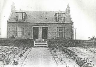
Stop 2 of 5
The Kilmarnock Arms was a base for Bram’s repeated holidays in the village then known as Port Erroll. Guestbook signatures in 1894 and 1895 provide a tangible record of his visits. Away from London’s theatre seasons, he found time to write; the coast also became the setting for The Watter’s Mou’ and The Mystery of the Sea.
The guide describes a hotel that once combined accommodation with the village post office. Letters and telegrams from the Lyceum followed Bram north, linking this quiet retreat to his work with Henry Irving. The nearby bridge also appears at the opening of The Mystery of the Sea, where Archibald Hunter encounters a disturbing vision of a funeral procession. Ask staff what Stoker material can currently be viewed; do not assume the original guestbook is on open display.
Working hotel: ask before entering or viewing memorabilia.
Estate guide: hotel and bridge, pages 4–5 ↗
Next: For the village walk, follow Main Street and Harbour Street towards Port Erroll harbour. Return by the same public streets.
Walking directions to the next stop ↗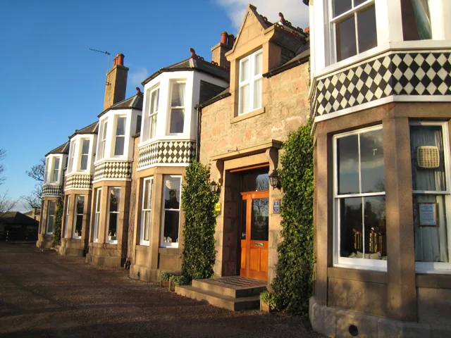
Stop 3 of 5
Bram came to know Port Erroll’s fishing community during his summer visits. In The Watter’s Mou’ he used its coastal setting for a story of a coastguard, smuggling and conflicting loyalties. The harbour stop introduces the working lives behind the picturesque view: the sea offered a livelihood and a danger, both of which mattered to his fiction.
His 1895 novel The Watter’s Mou’ follows Sailor Willie, a coastguard, and Maggie MacWhirter, whose father is involved in smuggling. Duty, loyalty and dangerous seas drive the story. The guide identifies the former Rocket House and Salmon Bothy on the approach to the harbour; use its illustrations to distinguish historic features from later changes. Look across the bay towards the dunes, then decide whether to return to the hotel or add the beach walk.
Working harbour: keep clear of operations and the water’s edge. This is the village branch, not the route to Slains.
Next: For the optional beach walk, return along Harbour Street to the signed beach approach and cross Ladiesbridge. For Slains, return to Main Street instead; the sandy bay is not the castle approach.
Directions back to the hotel ↗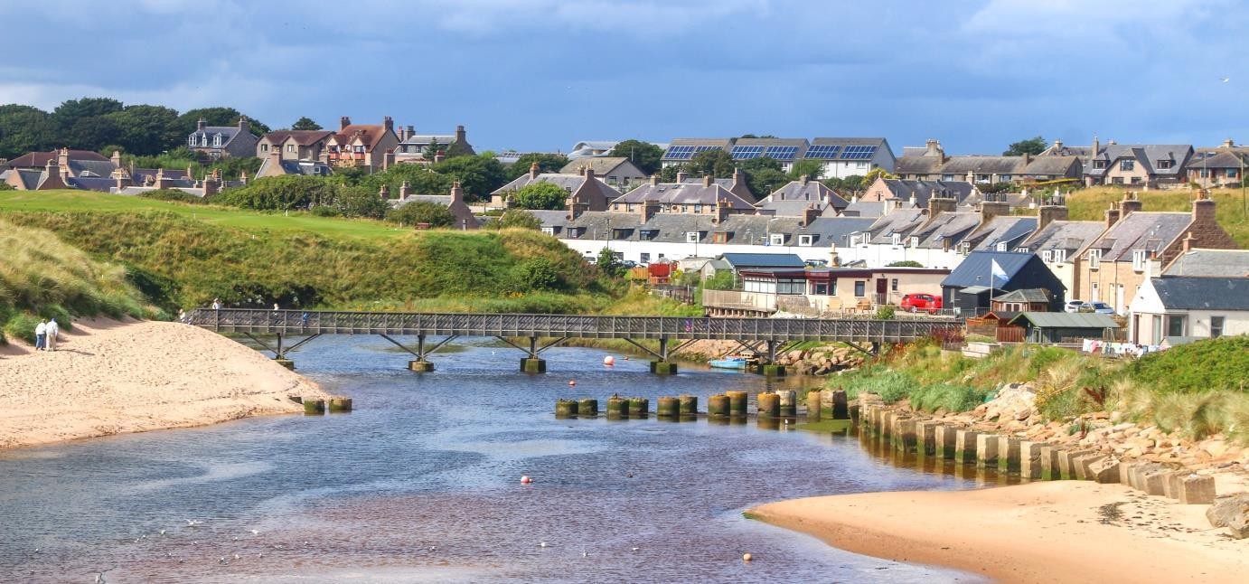
Stop 4 of 5
Walking the sands was part of Bram’s experience of Cruden Bay. His fiction returns to the beach and its rocks: The Mystery of the Sea uses the local coastal landscape, while Crooken Sands describes a visitor walking south along the bay towards isolated rocks. These passages make the beach a literary stop in its own right, alongside the village houses and castle.
For a short addition, walk south along the open sand for about 500 metres to 1 km, then turn back to the same bridge: roughly 1–2 km return, or 20–45 minutes depending on sand and pace. Choose a turning point that leaves plenty of time to return before the tide rises. This is an optional extension, not a necessary leg of the village or castle walks.
The sands have their own Stoker connection. The Estate guide discusses beach walks in The Mystery of the Sea and the isolated rocks called the Sand Craigs in Crooken Sands. Look towards the southern end of the bay without treating the rocks as a destination: the guide warns that the nearer crag becomes an island at high tide. The council’s full beach-and-Whinnyfold outing is 8.6 km return and involves rougher paths beyond the sand; plan that as a longer, separate walk.
Check the day’s tide times and the direction of the tide, weather and signs at the bridge. Keep your return to Ladiesbridge open; do not ford the river, go around rock outcrops or climb onto the Sand Craigs. Turn back if streams, surf or narrowing sand obstruct the way. The beach is not a route below the Slains cliffs.
Beach access via Ladiesbridge ↗
Estate guide: beach and Sand Craigs, pages 17–20 ↗
Council beach and Whinnyfold route ↗
SEPA: Cruden Bay beach profile ↗
Check tide forecasts and how to read them ↗
Next: Return across Ladiesbridge to the village. For Slains Castle, begin again from Main Street using the council’s signed inland approach.
Stop 5 of 5
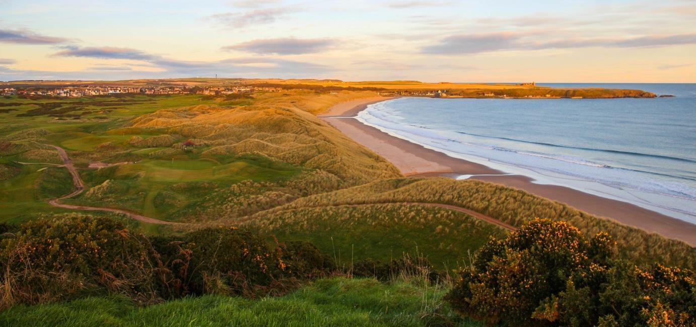
Bram knew Slains as part of the coastal landscape around his Cruden Bay writing holidays. The Estate guide compares its octagonal hall with the room in Castle Dracula, but notes that direct evidence of Bram entering the house is lacking. He had begun planning the novel before coming here: Slains offers a suggestive architectural and imaginative connection, rather than a proven single origin for Dracula.
The roofless ruin looks more Gothic today than the inhabited mansion Bram would have known. Its cliff-top position and surviving walls make a striking contrast with the open bay. The Estate guide discusses the similarity between Slains’s octagonal hall and the room Jonathan Harker enters in chapter two of Dracula. That is a suggestive architectural comparison, rather than proof that Slains supplied the whole story or that Bram’s entry into the house is documented.
Pause on the surrounding path to take in the building and the sea. Bram had already been developing Dracula before his first Cruden Bay visit, so this is best understood as part of his wider imaginative landscape. The guide also connects the nearby coastal inlet, the Watter’s Mou’, with his earlier novel; there is no need to descend towards the inlet or enter the ruin to appreciate that setting.
Exposed paths and unfenced cliff edges. Stay outside the ruin, do not climb masonry, and avoid the outing in high winds or poor visibility.
VisitAberdeenshire: current safety advice ↗
Council walking map and route descriptions ↗
Estate guide: Slains and its literary connections, pages 12–14 ↗
Historic Environment Scotland: the castle’s location ↗
Directions from the hotel to Slains ↗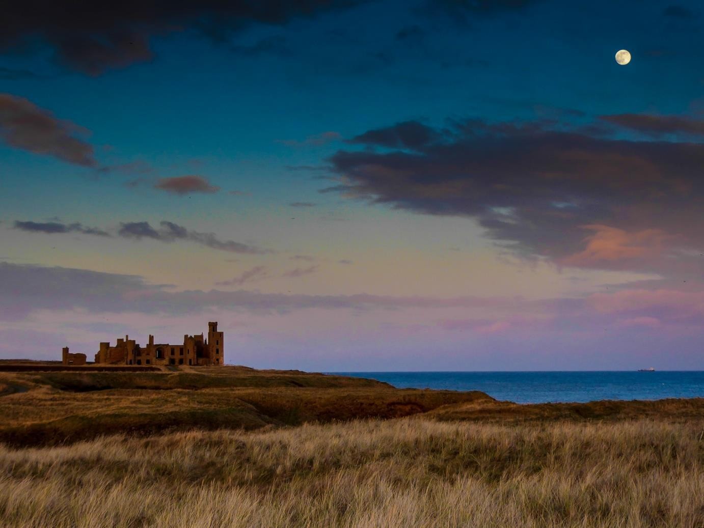
The original illustrated guide includes Hilton and Roselea cottages, the former grain store and further background to the harbour, Slains and the novels.
Read more →The council gives its full beach-and-Whinnyfold return walk as 8.6 km. The Estate guide continues the literary story to Crookit Lum Cottage and The Mystery of the Sea. Plan this separately, allowing time for tides, rough paths and a daylight return.
Read more →