
Keep the earlier guide with you
The original illustrated guide includes Hilton and Roselea cottages, the former grain store and further background to the harbour, Slains and the novels.
Read more about Keep the earlier guide with you → Official Estate
Self-guided walks
Bram first came to Port Erroll, now Cruden Bay, most probably in 1893 (earlier accounts give 1892), and returned almost every summer until 1910. Follow one continuous walk from his village lodgings to the harbour, across Ladiesbridge and south along the sands. Return to the village, then continue past the Watter’s Mou’ to Slains Castle and back. For the shorter walk, leave out the beach out-and-back and keep the village, harbour and Castle approach.
Lengths are approximate. Allow extra for crossings, detours and visits.
Numbered pins mark the stops. Tap a pin for a short introduction and photo, then tap the photo for full details. Choose “Return to map” when you are done. For more room on your phone, choose Full screen map above the map.
For the full walk, follow the open sand to the suggested turning area, then return across Ladiesbridge. Turn earlier if conditions require it. The shorter walk skips the beach out-and-back.
Showing your location is optional and needs no app. Tap Show my location and choose Allow for your blue dot. The pale circle shows estimated accuracy. Keep this page open and your screen awake. The Estate does not receive or save your coordinates. Map information and privacy.
Location is off.
Routes are a guide: follow local signs, crossings and current access conditions. Report a map issue.
1Main stopsAOptional stopsMain routeOptional detoursBeach (full walk)
The beach line is illustrative, not a fixed path or a tide forecast. Follow the open sand, turn earlier if needed and return over the same bridge. The Castle approach starts from Main Street after you return to the village.
Open the illustrated Cruden Bay PDF →Stop 1 of 6
Holiday lodging · from about 1896
The village’s literary history begins at the scale of a garden and a summer’s working day. Hilton Cottage helps place the novels among the ordinary arrangements of Bram’s holidays.
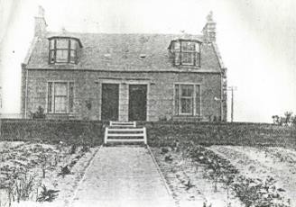
Look for a granite house in the upper Bridge Street area, its garden screened from the road. Hilton Cottage was once an annexe of the Kilmarnock Arms, and the Estate guide identifies it as Bram’s principal holiday lodging here, probably from 1896 onwards.
Local memory supplies the scene: Bram sat writing at a round table in the garden, and the village remembered his distinctive bicycle. These were working holidays, when the summer break from the London theatre gave him time to write.
Over almost two decades of visits he lodged in several places. Before this cottage he stayed at the hotel down the street; later came Roselea, also on Bridge Street, and the Crooked Lum at Whinnyfold, close to the coast of The Mystery of the Sea.
The granite walls and roofline, matched against the guide’s 1908 photograph of the cottage. The garden where Bram is remembered writing lies behind the house.
“The village, squatted beside the emboucher of the Water of Cruden at the northern side of the bay is simple enough; a few rows of fishermen’s cottages…”
The Estate guide identifies the cottage, and Bram’s stays here rest on local recollection, probably from 1896. The pin marks the upper Bridge Street area rather than a verified doorway. The recollections do not show which chapters of Dracula he wrote here.
Private home. View it from the public street and please do not enter the garden or grounds.
Next: Walk down Bridge Street to the Kilmarnock Arms.
↑ Return to map from stop 1: Hilton Cottage – upper Bridge Street area
Stop 2 of 6
Hotel stays · guestbook signatures 1894 and 1895
Both versions return here before the Castle approach, then finish here after the Castle.
A few lines in a guestbook bring the writer close to the everyday life of a working hotel. They give this literary stop the warmth of a place he was glad to return to.
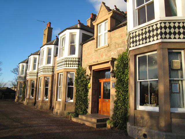
Look up at the plaque on the hotel, placed under Historic Environment Scotland’s 2018 scheme, which reads: “Wrote the early chapters of ‘Dracula’ here in 1895.” An information board, unveiled at the hotel in 2022, outlines Aberdeenshire’s links with the novel.
The hotel was Bram’s base on holidays in the village then called Port Erroll. In 1894 he signed its guestbook as a returning visitor, and the Estate guide records a stay in 1895. It was then a temperance hotel with a post office, so letters and telegrams from the Lyceum followed him here.
Now turn to the bridge over the Water of Cruden, because The Mystery of the Sea opens on its low wall, where Archibald Hunter sits after breakfast and glimpses a man carrying a small coffin.
The 2018 plaque and the 2022 information board at the hotel. Then the bridge and its low wall, where The Mystery of the Sea begins.
“Second visit to Port Erroll. Delighted with everything & everybody & hope to come again to the Kilmarnock Arms.”
“I had just arrived at Cruden Bay on my annual visit, and after a late breakfast was sitting on the low wall which was a continuation of the escarpment of the bridge over the Water of Cruden.”
The guestbook signatures of 1894 and 1895 are the firm record. Historic Environment Scotland dates his first visit to 1893; earlier accounts give 1892. The plaque’s wording is commemorative, and Bram had begun planning Dracula before his Cruden Bay visits.
Working hotel. Ask staff before entering or viewing memorabilia; the guestbook is not necessarily on display.
Estate guide: hotel and bridge, pages 4–5 ↗
Historic Environment Scotland: Bram’s commemorative plaque ↗
Next: Follow Main Street and Harbour Street to Port Erroll harbour, then Ladiesbridge. For the full walk, take the beach out-and-back; for the shorter walk, stay off the sand and return through the village before continuing towards the Castle.
Optional A · Lunch or tea
Documented connection · Bram’s holiday hotel
Take an optional break at the Kilmarnock Arms, where Bram’s stays are recorded in the hotel guestbook.
Brams Bar offers relaxed dining at the hotel already included as a historical stop on this walk. Check the current food service and book a table directly with the hotel if you want to eat here. Ask about tea or lighter refreshments when planning your visit.
Another family connection appears in the earlier guide: Florence contributed a “Dracula Salad” to the parish’s 1912 recipe booklet, using tomatoes and purple plums with a French dressing. The booklet supported a local church bazaar, reflecting the family’s continuing links with Cruden Bay.
Guestbook entries and the commemorative plaque document the hotel’s Bram Stoker connection. The present-day bar and menus are part of the hotel’s current dining offer.
Optional and paid; check opening and food-service times, accessibility and dietary needs directly with the hotel.
Historic Environment Scotland: Bram Stoker ↗
Food, drink and reservations ↗
Florence’s Dracula Salad in the earlier guide, pages 20–21 ↗
Next: Rejoin the village walk towards Port Erroll harbour, or return to your chosen coastal section.
↑ Return to map from optional stop A: Kilmarnock Arms – optional lunch at Brams Bar
Stop 3 of 6
Fiction · Story setting · The Watter’s Mou’, 1895
Before it becomes a story setting, this is a place of boats, work and shelter. Read the harbour with those practical demands in mind: they give Bram’s coastal fiction much of its force.
Look down into the tiny harbour, cut from the rocks at the eastern end of the bay. Bram came to know Port Erroll’s fishing families on his summer visits, and here the sea meant both a living and a danger – both mattered to his fiction.
In The Watter’s Mou’ (1895), the coastguard Sailor Willie loves Maggie MacWhirter, whose father is involved in smuggling. The story opens on a wild night, with the coastguard pacing his lookout on the cliff above this harbour. Its conflict between duty and loyalty gives these quays a specific literary connection.
On the approach, the former Rocket House and the Salmon Bothy recall the rescue crews and salmon fishers of the working coast, the world behind Bram’s story.
The former Rocket House and Salmon Bothy on the approach, identified from the guide’s photographs. Then the harbour basins, and the cliff top above them where the story places the coastguard’s lookout.
“In the little lookout house on the top of the cliff over the tiny harbor of Port Erroll the coastguard on duty was pacing rapidly to and fro.”
“The harbor of Port Erroll is a tiny haven of refuge won from the jagged rocks that bound the eastern side of Cruden Bay.”
The story names Port Erroll and Cruden Bay, so the setting is Bram’s own; its people are fictional. Quotations follow the 1895 New York edition, which uses American spelling.
Working harbour: keep clear of operations and the water’s edge. The next section returns along Harbour Street to the beach bridge.
Next: Retrace Harbour Street to the signed beach approach. Cross the Water of Cruden on Ladiesbridge; do not try to cross the river mouth on the sand.
Stop 4 of 6
Fiction · Holiday shore and story setting · visits 1890s–1910
Shorter walk: skip the beach out-and-back. Stay by Ladiesbridge, return through the village and continue to the Watter’s Mou’ and Slains Castle.
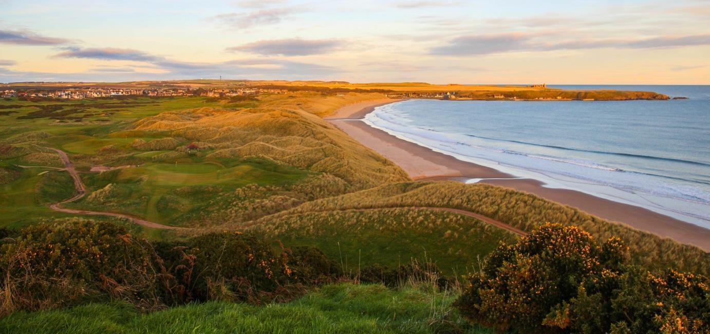
The curve of the shore, changing waterline and distant rocks make this a walk within the walk. Leave room for the landscape itself as well as the stories Bram set here.
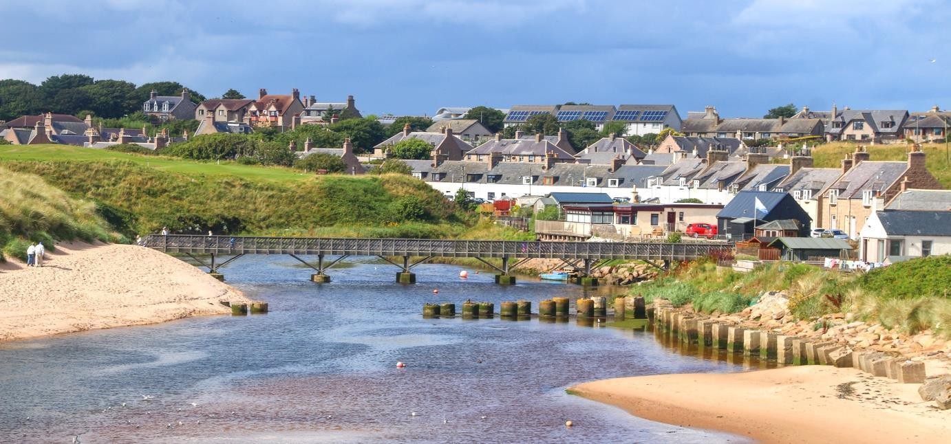
Step off Ladiesbridge onto the open sand and look south along the curve of the bay, where walking these sands was part of Bram’s Cruden Bay holidays, and the beach runs through his fiction.
The Mystery of the Sea (1902) describes the dunes, the stake nets and a sea that runs far out at low water. In Crooken Sands, a London merchant in brand-new Highland dress strolls south by moonlight and climbs one of two isolated rocks. The Estate guide links these sands with the novel and the Sand Craigs with the story.
The earlier Estate guide collects memories of Bram setting out at about seven in the morning and returning for breakfast. Villagers recalled his stout walking stick and his absorbed, head-down stride, with his hands behind his back. These were thinking walks as well as exercise.
From the beach end of Ladiesbridge, follow the open sand south towards the Sand Craigs. The map suggests a turning area before the rocks, about 2.3 km from the bridge. Enjoy the view from the sand, then turn round and retrace the beach to Ladiesbridge. There is no beach exit into the Castle section: cross the same bridge back into the village.
The guide also quotes Florence’s 1927 recollection of Bram sitting “like a great bat” on the shore rocks, or wandering the sandhills while thinking out Dracula. Her memory gives the landscape another connection with the writing of the novel; it does not identify one particular rock.
The long curve of firm sand, the dunes behind it and, to the south, the Sand Craigs standing apart on the beach.
“Cruden sands are wide and firm and the sea runs out a considerable distance.”
“The bay itself is floored with level sand and the tide runs far out, leaving a smooth waste of hard sand on which are dotted here and there the stake nets and bag nets of the salmon fishers.”
Bram’s beach walks are holiday tradition rather than dated record. Crooken Sands renames the bay; matching its rocks to the Sand Craigs is the Estate guide’s reading.
Allow about 4.5 km / 2.8 miles and 1–1½ hours for the mapped beach out-and-back. Use Ladiesbridge for the river crossing in both directions. The sand line is illustrative and changes with tides and weather; turn sooner whenever necessary.
Beach access via Ladiesbridge ↗
Estate guide: beach and Sand Craigs, pages 17–20 ↗
Council beach and Whinnyfold route ↗
SEPA: Cruden Bay beach profile ↗
Check tide forecasts and how to read them ↗
Earlier Estate guide: morning walks and Florence’s recollection, pages 17–20 ↗
Next: Full walk: return north along the same beach and cross Ladiesbridge. Shorter walk: view the beach from Ladiesbridge and skip the sand out-and-back. Both versions then follow Harbour Street and Main Street back to the Kilmarnock Arms, before continuing through the Main Street car park onto the signed path to the Watter’s Mou’ and Slains Castle.
↑ Return to map from stop 4: Cruden Bay beach – Ladiesbridge and the Sand Craigs
Stop 5 of 6
Fictional use of a real location · The Watter’s Mou’, 1895
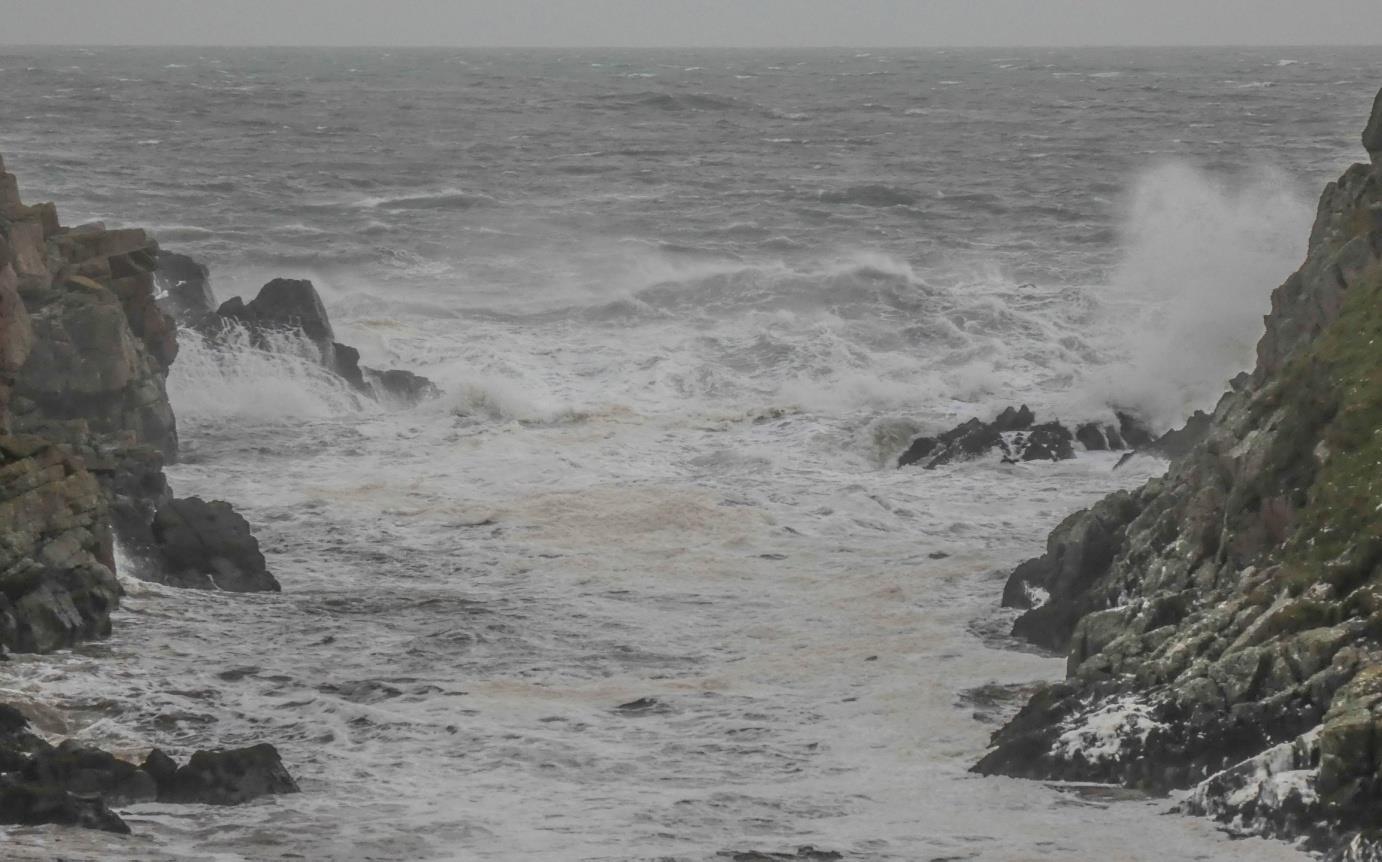
Water gives this red-granite coast much of its drama. At this pause beside the gorge, that movement becomes a way into Bram’s writing about the sea.
After the woodland bridge, keep to the signed approach towards Slains. Read the inlet’s story from the path beside the gorge. The Estate guide identifies the cleft farther downstream as the Watter’s Mou’ – the “water’s mouth”. Continue along the path after reading; there is no need to seek a closer position on the rocks.
The harbour introduced Sailor Willie and Maggie MacWhirter. This inlet supplies their story’s threatening landscape and tragic ending. Bram describes granite rocks resembling the teeth of a mouth, with the sea surging in and out between them.
The guide relates this imagery to a possible earlier idea in Bram’s notebook: “The Angry Waters”, a sea that kills and then mourns. It reports the editors’ suggestion that the note may refer to The Watter’s Mou’. This is an interpretation of the developing story, rather than proof that the inlet supplied Dracula’s plot.
The pin marks a reading stop on the signed path beside the gorge. The inlet mouth lies farther downstream below the cliffs; the walk stays on the approach path. Keep well back from exposed, unguarded edges, follow local notices and omit this section in high winds or poor visibility. Do not descend towards the inlet.
Earlier Estate guide: the Watter’s Mou’, pages 9–11 ↗
Next: Continue on the signed path towards Slains Castle. The mapped Castle pin is on the approach path outside the ruin; remain outside its walls.
↑ Return to map from stop 5: The Watter’s Mou’ – a reading stop beside the gorge
Stop 6 of 6
One of the possible inspirations for Dracula’s Castle · Clifftop mansion, now a ruin · Bram’s holidays 1893–1910
The last landmark of the walk is a good place to bring the real landscape and the imagined castle into the same frame. The details that invite comparison are smaller than the dramatic silhouette.
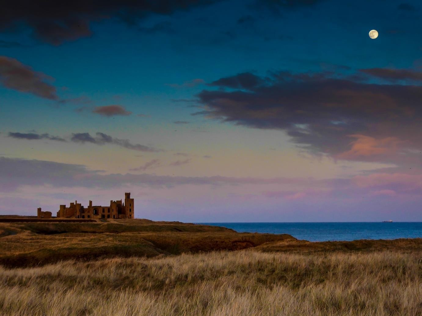
Look at the roofless ruin on the cliff edge and picture the inhabited mansion Bram would have known. He knew Slains as part of the coastal landscape around his Cruden Bay writing holidays, a short walk from his lodgings in the village.
The Estate guide points to the castle’s octagonal hall. In Chapter 2 of Dracula, the Count leads Jonathan through his castle, crosses a supper room and opens a door into a small octagonal room lit by a single lamp.
That resemblance is an argument from architecture, and a good reason to walk out here. Bram had begun planning the novel before his Cruden Bay visits, so Slains is one possible influence among many, alongside the reading, travel and imagination that fed the book.
The outline of the castle from the surrounding path: its roofless walls and empty windows above the sea. There is no need to go closer.
“…opened another door, which led into a small octagonal room lit by a single lamp, and seemingly without a window of any sort.”
Direct evidence of Bram entering the house has not been established.
The mapped viewpoint is on the approach path outside the ruin. This final section, including the Watter’s Mou’, is about 3.3 km return from the hotel. Stay outside the walls and well back from the unguarded cliffs; omit it in high winds or poor visibility.
VisitAberdeenshire: current safety advice ↗
Council walking map and route descriptions ↗
Estate guide: Slains and its literary connections, pages 12–14 ↗
Historic Environment Scotland: the castle’s location ↗
Historic Environment Scotland: New Slains Castle history ↗
Retrace the signed path past the Watter’s Mou’ and the woodland bridge to the Main Street car park. Return to the Kilmarnock Arms, where the full walk finishes.
↑ Return to map from stop 6: Slains Castle – view from the approach path
The original illustrated guide includes Hilton and Roselea cottages, the former grain store and further background to the harbour, Slains and the novels.
Read more about Keep the earlier guide with you →The full walk turns before the Sand Craigs and returns to Ladiesbridge. Continuing around the southern headland to Whinnyfold is a separate extension over rougher ground; the council’s complete village–Whinnyfold return route is 8.6 km. Plan that independently, with tides and a daylight return in mind.
Read more about A longer beach outing to Whinnyfold →Roselea is on Bridge Street and is described in the guide as a probable early-1900s overflow lodging. Crooked Lum is in Whinnyfold, a separate outing; the stay there was in his later visits; the year is not firmly established. Both are private homes, not interiors open to visitors. The earlier guide records local memories of Bram and Florence stopping for tea and scones at Crooked Lum before their later stay there. It is now a private home, not a public tearoom.
Read more about Roselea and Crooked Lum – the other lodgings →