Add the present Whitby Museum
Visit Pannett Park separately to learn more about the town and its collections. This is the Museum’s present location, not the Pier Road premises Bram visited.
Read more → Official Estate
Self-guided walks
Trace Bram’s holiday landscape from his 1890 lodging to the harbour and East Cliff. The walk distinguishes documented visits from the fictional movements of Mina and Lucy.
Lengths are approximate. Allow extra for crossings, detours and visits.
Tap a numbered pin for a short introduction and photo. Tap the photo to open the full details, then use “Return to map” to come back. Tap Show my location and choose Allow to see your blue dot as you walk. No app is needed. The pale blue circle shows your phone’s estimated accuracy.
Location is off. You can use the map and stop list without sharing it.
Numbered pins match the list. Burgundy lines follow mapped walking routes; dashed green lines are optional outings. Routes are a guide: follow local signs, crossings and current access conditions. Report a map issue. Route data: OpenStreetMap, prepared with FOSSGIS / OSRM.
Location is optional and stays in this page’s memory; the Estate does not receive or save your coordinates. Map tiles are requested from OpenStreetMap for the area you view. Opening Apple Maps or Google Maps uses that provider’s service. Location privacy.
Keep the page open and your screen awake for updates. Updates may pause when the phone locks or the browser is in the background. Accuracy and signal vary; this is not an offline guide.
This is a steep route with steps. The 199 Steps are not a step-free route; arrange transport to East Cliff if needed. Check church and Abbey access before setting out.
Stop 1 of 5
Bram stayed at Mrs Veazey’s lodging house at 6 Royal Crescent in the summer of 1890, and Florence and Noel joined him during the holiday. He explored Whitby while developing the story that became Dracula. The house anchors that documented visit; the fictional arrival of the Count is a separate story constructed from the town’s landscape and Bram’s research.
Begin with the contrast between a quiet lodging-house holiday and the unsettling town that appears in the novel. The house is a biographical anchor; the vampire’s arrival belongs to fiction. From here the route moves towards the harbour view before descending into the streets below, so orient yourself towards East Cliff.
Private property: view the exterior and plaque from the pavement.
Whitby Museum: Bram’s 1890 visit ↗
Next: Follow the West Cliff public streets towards the harbour viewpoint.
Walking directions to the next stop ↗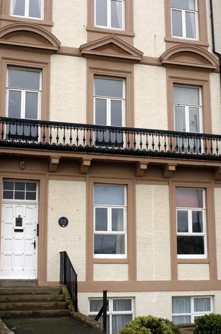
Stop 2 of 5
During his Whitby stay, Bram looked across the harbour towards St Mary’s churchyard and the Abbey, a townscape he later used in Dracula. His novel turns views between the two cliffs into part of Mina and Lucy’s experience. This stop lets you connect the author’s documented holiday with the fictional geography, while noticing that later monuments and pier extensions have changed the view.
Use the Museum’s account to compare 1890 with today: the pier extensions and Caedmon’s Cross were later additions too. Pick out the harbour entrance, churchyard and ruins as separate features. This view introduces the geography of Dracula’s Whitby chapters before you cross the river and climb the steps.
Use public paths and choose a descent suited to your group; some approaches have steps.
Whitby Museum: the changing landscape ↗
Next: Descend by public streets towards Pier Road.
Walking directions to the next stop ↗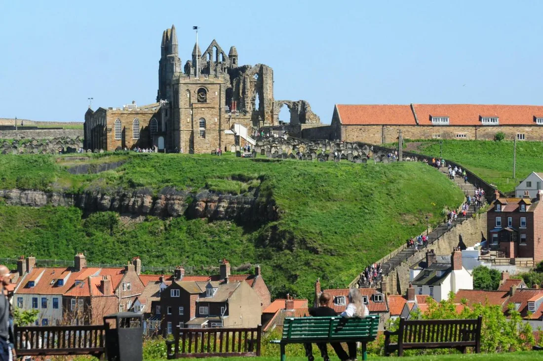
Stop 3 of 5
Bram signed Whitby Museum’s visitors’ book on 19 August 1890, when it occupied premises on Pier Road above the Subscription Library. Reading during the holiday fed his developing novel, including William Wilkinson’s account of Wallachia and Moldavia and the name Dracula. The Museum’s record provides evidence of the visit; the pin identifies the street area, not a verified original doorway.
The Museum’s surviving visitors’ book provides firmer evidence than a modern attraction’s name. Its account distinguishes the Museum from the Subscription Library below. English Heritage explains how William Wilkinson’s book supplied the name Dracula. Pause here to connect the holiday landscape with the practical research behind the novel.
Street stop; the photograph is an overview of Whitby, not an identification of the former library building.
Museum’s account and visitor-book evidence ↗
English Heritage: Whitby and Dracula ↗
Next: Use the swing bridge, then Church Street and the signed 199 Steps to reach the churchyard.
Walking directions to the next stop ↗Stop 4 of 5
Bram explored St Mary’s churchyard and transcribed names from its gravestones during the 1890 holiday. In Dracula, the churchyard becomes a meeting place, viewpoint and scene of growing unease in Mina’s account. These connections are literary and biographical; there is no grave of the fictional Count to seek among the real memorials.
After the climb, look back towards the harbour and opposite cliff before continuing to the Abbey. In the novel the churchyard is a place of conversation, observation and growing unease. Keep to paths and treat it as a churchyard with real memorials: the fictional Count has no grave to find here.
Treat the churchyard as a place of worship and remembrance. The climb is steep; do not climb on gravestones.
English Heritage: Dracula and Whitby ↗
Next: Continue along the signed East Cliff route to the Abbey visitor entrance.
Walking directions to the next stop ↗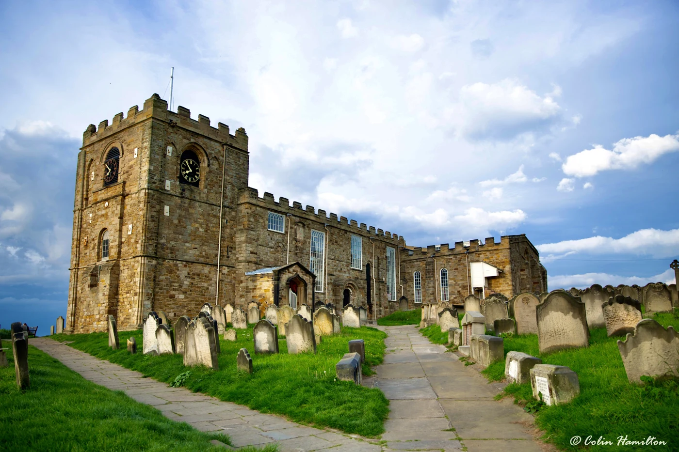
Stop 5 of 5
The Abbey ruins were part of the Whitby skyline Bram encountered in 1890 and the atmospheric setting he gave to Dracula. Their silhouette above the harbour connects this final stop with the views from West Cliff earlier in the walk. The ruin has its own medieval history, however, and should not be reduced to a stage set for a Victorian novel.
Take time to separate the medieval ruin from the Victorian story attached to it. Its open arches and exposed position create a powerful silhouette across the harbour, while a closer visit rewards attention to stonework and surviving structure. Allow additional time for the paid site and English Heritage’s interpretation, beyond the walking estimate.
Abbey entry is subject to opening and admission; check current access information.
Visit Pannett Park separately to learn more about the town and its collections. This is the Museum’s present location, not the Pier Road premises Bram visited.
Read more →Chapters 6–8 provide a useful reading companion. Their events belong to fiction, not a diary of Bram’s own walks.
Read more →